Clarence River Rafting
  • Home
  • Multi-day Clarence
    • 5-6 Days
    • 4 Days
    • 3 Days
  • Half Day Clarence
  • Shuttles and Rentals
    • Explore More
    • The Clarence River
    • Clarence River overview
    • River Grading and Safety
    • Our Location
      • Our Story
  • Bookings and Enquiries
  • Contact
  1. You are here:  
  2. Home
  3. Uncategorised

Contact Ben, Jordan, or Nicole

Clarence River Rafting would love to hear from you.

The best way for all enquiries is to visit our booking and enquiries form, providing your group information and preferred trip.  We will get back to you as soon as we can to start planning your adventure.

Book or enquire Now 

Else you are always welcome give us a call or email us.

Call us direct: +64 27 224 3345

Email us here: This email address is being protected from spambots. You need JavaScript enabled to view it.

To help you plan your journey, here's our exact location:


The Waiau River

New Zealand's wilderness waterway - remote, powerful, pristine

Te Waiau - The Swirling Waters

The Waiau River is one of Canterbury's major river systems and the Clarence River's (Waiau Toa) bigger sister. While both rivers share the "Waiau" name element - meaning "swirling waters" or "current of water" in Te Reo Māori - they are distinct river systems with their own character and charm.

The Waiau River is larger, longer, and more powerful than the Clarence, flowing through even more remote wilderness in the Kaikōura backcountry. It offers multi-day rafting expeditions through landscapes that few New Zealanders ever see.

🌊 Two Great Rivers

Waiau Toa (Clarence River): "The river of the great cold water" or "the brave flowing water" - our signature half-day rafting destination.

Waiau River: Simply "Te Waiau" (the swirling waters) - our multi-day expedition destination, offering more remote and sustained wilderness rafting.

Both rivers flow through the same general region but are separate waterways with different characters, challenges, and experiences.

River Geography

Course & Catchment

The Waiau River has an extensive catchment in the inland Kaikōura region:

  • Length: Approximately 169 kilometers
  • Source: Spenser Mountains and St James Range
  • Tributaries: Fed by numerous high country streams
  • Mouth: Joins the Waiau Uwha River system
  • Catchment Area: Approximately 3,000 km²
  • Flow: Higher volume than the Clarence - typically 80-150 m³/s
  • Elevation Drop: From over 2,000m to approximately 400m

River Character

The Waiau is characteristically different from the Clarence:

  • Larger Volume: Carries significantly more water
  • Deeper Channels: Less braiding than the Clarence, more defined channels
  • Faster Flow: Steeper gradient in many sections
  • Longer Rapids: More sustained whitewater sequences
  • Bigger Waves: More powerful hydraulic features
  • Color: Same stunning turquoise-blue from glacial flour

Geology & Landscape

Tectonic Setting

Like the Clarence, the Waiau River flows through one of New Zealand's most geologically active regions. The river valley shows evidence of ongoing tectonic activity:

  • Active Faults: Multiple fault lines cross the valley
  • Earthquake Impact: The 2016 Kaikōura earthquake affected the Waiau valley
  • Uplift Features: Visible river terraces showing ancient river levels
  • Landslide Evidence: Major slides from the 2016 quake still visible
  • Greywacke Geology: Same hard, grey sandstone as the Clarence

The Waiau Valley

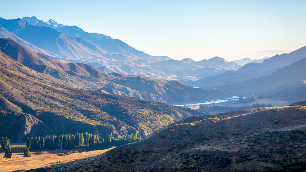
The Waiau flows through spectacular high country:

🏔️ Mountain Ranges

Surrounded by the Spenser Mountains, St James Range, and Inland Kaikōura Range. Peaks rise to over 2,400 meters, creating dramatic valley scenery with snow-capped summits visible year-round.

🌲 Beech Forest

Unlike the more open Clarence valley, sections of the Waiau valley feature extensive native beech forest. These forests provide habitat for native birds and add to the wilderness feeling.

🏞️ Gorge Sections

The Waiau cuts through several dramatic gorges where the valley narrows and the river accelerates. These gorges create the most exciting rapids and spectacular scenery.

🏕️ Gravel Beaches

Wide gravel flats and beaches perfect for wilderness camping. These pristine camping spots are only accessible by river, ensuring complete solitude.

Rapids & Whitewater

Grade II-III Character

The Waiau offers more sustained and technical whitewater than the Clarence:

  • Longer Rapids: Rapids that last several minutes rather than brief sequences
  • Wave Trains: Beautiful standing wave patterns perfect for surfing
  • Technical Sections: Routes require reading and maneuvering
  • Pool-Drop Pattern: Exciting rapids followed by calm pools for recovery
  • Volume-Dependent: Character changes significantly with water level
  • Grade III+ Sections: Some sections approach Grade IV at higher flows

Notable Rapids

The Waiau features several named rapid sections that provide memorable whitewater experiences. Our guides know every rapid, rock, and current - ensuring both safety and excitement as you navigate this wilderness river.

Ecology & Wildlife

Native Birds

The Waiau valley supports rich birdlife, particularly in forested sections:

  • Kea: The world's only alpine parrot, occasionally seen in higher elevations
  • New Zealand Falcon / Kārearea: Often hunting along the river
  • Paradise Shelduck / Pūtangitangi: Very common on the river
  • Blue Duck / Whio: Endangered native duck, occasionally spotted
  • Rifleman / Tītipounamu: NZ's smallest bird, in riverside forest
  • Grey Warbler / Riroriro: Common in beech forest
  • Fantail / Pīwakawaka: Friendly native bird often following rafts
  • New Zealand Pigeon / Kererū: In forest areas

Fish Life

The Waiau is renowned for its fishing:

  • Brown Trout: Excellent trophy trout fishing (permit required)
  • Rainbow Trout: Also present in good numbers
  • Native Galaxiids: Several species of native fish
  • Longfin Eels / Tuna: Large eels in deeper pools
  • Upland Bullies: Small native fish in tributaries

Note: Fishing licenses required. Our multi-day trips can incorporate fishing time for those interested.

Vegetation

More diverse vegetation than the Clarence:

  • Beech Forest: Red, silver, and mountain beech in valleys
  • Kānuka: Native scrubland along riverbanks
  • Matagouri: Spiky native shrub in drier areas
  • Tussock: Native grasses on higher terraces
  • Alpine Plants: Various alpine species in higher elevations

Cultural & Historical Significance

Māori History

Like the Clarence, the Waiau River held importance for Ngāi Tahu:

  • Travel Route: Used as a route between east and west coasts
  • Food Source: Eels, fish, and birds provided sustenance
  • Mahinga Kai: Traditional food gathering places along the river
  • Pounamu Routes: Routes to greenstone areas passed through the valley

European Settlement

The Waiau valley became important for high country pastoralism:

  • Sheep Stations: Remote high country stations established in the 1800s
  • Molesworth Connection: The valley borders Molesworth Station lands
  • Musterers' Routes: Historic stock routes through the valley
  • Remote Settlement: One of NZ's most isolated farming areas

Modern Use

Today the Waiau valley remains largely unchanged:

  • Conservation: Large areas in conservation estate
  • Recreation: Rafting, fishing, hunting, tramping
  • Limited Access: Few roads, mostly 4WD tracks
  • Wilderness Values: Protected for its remote character

Seasons & Conditions

🌸 Spring (October - November)

Flow: High - heavy snowmelt
Water Temp: Cold (7-11°C)
Rapids: More powerful, some sections Grade IV
Character: Exciting, fast-flowing, challenging
Landscape: Fresh green growth, wildflowers
Note: For experienced rafters only at high flows

☀️ Summer (December - February)

Flow: Moderate - ideal conditions
Water Temp: Moderate (11-15°C)
Rapids: Grade II-III, perfect balance
Character: Excellent rafting, comfortable camping
Landscape: Golden tussock, blue skies
Note: Best time for multi-day trips

🍂 Autumn (March - April)

Flow: Lower - clear water
Water Temp: Cooling (9-13°C)
Rapids: Grade II-III, very clear
Character: Scenic, excellent for fishing
Landscape: Autumn colors in beech forest
Note: Beautiful time for expeditions

❄️ Winter (May - September)

Flow: Variable - rain-dependent
Water Temp: Very cold (5-9°C)
Rapids: Depends on rainfall
Character: Challenging conditions
Landscape: Snow to valley floor, dramatic
Note: Limited trips, experienced groups only

Waiau vs Clarence (Waiau Toa)

Both rivers offer spectacular experiences but are quite different:

Feature Clarence / Waiau Toa Waiau River
Length 209 km 169 km
Volume 70-100 m³/s 80-150 m³/s (larger)
Character Braided, wide valley More defined channels, narrower
Rafting Grade Grade II Grade II-III
Our Trips Half-day & multi-day Multi-day expeditions
Best For Families, first-timers Adventurers, wilderness seekers
Access Relatively accessible More remote
Vegetation Mostly tussock & scrub Includes native forest

Conservation & Access

Protected Status

The Waiau River and its catchment have significant conservation values:

  • DOC Estate: Significant portions in Department of Conservation land
  • Scenic Reserves: Areas protected for natural beauty
  • Fish & Game: Managed for recreational fishing
  • Wilderness Values: Remote character protected

Access Limitations

The Waiau's remoteness is part of its appeal:

  • Few Roads: Limited road access to the river
  • 4WD Only: Most access requires high-clearance vehicles
  • Private Land: Much of the valley is private farmland
  • DOC Permits: Commercial operators need concessions
  • River Access: Best access is by rafting!
Quick Facts

  • Length: 169 km
  • Catchment: ~3,000 km²
  • Māori Name: Te Waiau
  • Type: Mountain river
  • Grade: II-III (rafting sections)
  • Flow: 80-150 m³/s
  • Best Season: Nov-March

🎣 Fishing Paradise

The Waiau is renowned for trophy trout fishing. Our multi-day rafting trips can include fishing time for licensed anglers.

  • Brown trout to 5kg+
  • Rainbow trout abundant
  • Remote pools rarely fished

Experience the Waiau

3-5 Day Expeditions → Custom Waiau Trips → Enquire Now →

Compare Rivers

Clarence River / Waiau Toa → Understanding River Grades →

Learn More

About Kaikōura Region → Photo Gallery →

Explore the Waiau Wilderness

Experience multi-day expeditions on one of New Zealand's most remote rivers

View Waiau Trips Ask Questions
 

The Clarence River / Waiau Toa

New Zealand's geological wonder - shaped by earthquakes

Te Waiau Toa - The Great Cold Water

The Clarence River, known in Te Reo Māori as Waiau Toa (pronounced "Why-ow Toe-ah"), meaning "male river of swirling currents" is one of New Zealand's most spectacular alpine rivers. Flowing 230 kilometers from the Spenser Mountains to the Pacific Ocean near Kaikōura, this braided river system offers a unique window into Earth's dynamic geology.

The river drains a massive 3,442 square kilometer catchment in the northeast of New Zealand's South Island, carving through the Kaikōura Ranges and creating some of the most dramatic river scenery in Aotearoa.

🌍 The 2016 Kaikōura Earthquake

On November 14, 2016, at 12:02 am, a magnitude 7.8 earthquake struck Kaikōura, causing massive landscape changes along the Clarence River. Multiple fault lines ruptured simultaneously - at least 21 faults moved during the quake - uplifting river terraces by several meters, creating new rapids, and fundamentally reshaping the river valley.

Today, rafting the Clarence River offers a unique opportunity to witness these recent geological changes firsthand. You'll see fault scarps, uplifted terraces, and landslide features that are still fresh and clearly visible in the landscape - geological features that are usually millions of years old, but here are less than 10 years old!

River Character

Geography & Flow

The Clarence is a braided river system - characterized by multiple channels that split and rejoin, creating a constantly changing pattern across a wide gravel riverbed. This braiding is typical of rivers carrying high sediment loads from mountainous terrain.

  • Length: 230 kilometers
  • Source: Spenser Mountains, Southern Alps
  • Mouth: Pacific Ocean, north of Kaikōura
  • Catchment: 3,442 km²
  • Average Flow: 70-100 m³/s (highly seasonal)
  • Gradient: Steep in upper reaches, moderate in rafting section
  • Elevation Drop: From 1,800m to sea level

Water Quality & Color

The Clarence is renowned for its stunning turquoise-blue color, particularly in the lower reaches where we operate. This distinctive color comes from "glacial flour" - extremely fine rock particles ground up by the erosive action of mountain streams and the weathering of greywacke rock. These suspended particles scatter light, creating that characteristic milky-blue appearance.

Water quality is excellent, with the river remaining remarkably clean despite its sediment load. The cold, clear water supports a diverse ecosystem of aquatic life. Water temperature ranges from 6-8°C in winter to 12-16°C in summer.

Geology & Earthquake Features

Active Fault Lines

The Clarence River valley is one of the most geologically active areas in New Zealand, sitting at the boundary of the Pacific and Australian tectonic plates. The 2016 Kaikōura earthquake was so complex that scientists are still studying it today - it ruptured multiple faults simultaneously, something rarely observed.

⚡ Hope Fault

One of New Zealand's major strike-slip faults, clearly visible from the river. The 2016 earthquake caused up to 12 meters of horizontal movement along sections of this fault. You can see the offset in the landscape as you raft.

🗻 Kaikōura Ranges

Towering mountains on both sides of the river, rapidly uplifting due to tectonic forces. Some peaks rose by over 2 meters during the 2016 quake. The ranges continue to rise at approximately 1-6mm per year.

🏔️ Uplifted River Terraces

Multiple levels of ancient riverbeds now sit high above the current river level. The 2016 earthquake created brand new terraces - former riverbeds that were lifted up to 10 meters in seconds. These show how the river has cut down through the landscape over thousands of years.

🌊 Massive Landslides

The earthquake triggered over 100,000 landslides in the region. Some were so large they temporarily dammed the Clarence River and its tributaries, creating new lakes. Most have now been washed away, but evidence remains throughout the valley.

📏 Ground Ruptures

Visible cracks in the ground where the earth literally split open. Some ruptures are over a meter wide and can be traced for kilometers across the landscape. These are rare features to see so clearly.

🪨 Greywacke Rock

The Clarence valley is carved through greywacke - a hard, grey sandstone that forms the backbone of New Zealand. This rock is 100-200 million years old and makes up most of the Kaikōura Ranges.

Rafting Section

We operate on approximately 190kms of the Waiau Toa / Clarence River.   This section offers perfect Grade II rafting conditions while passing through a wide variety of country. 

Why This Section is Special

  • Visible Fault Lines: Multiple active faults cross the valley - you'll see where the ground moved
  • Fresh Earthquake Features: Unlike most geological sites, these features are brand new
  • Perfect Rapids: Grade II rapids provide excitement without overwhelming first-timers
  • Stunning Scenery: Surrounded by mountains rising to 2,600+ meters
  • Accessible Wilderness: Remote feeling despite being relatively accessible
  • Braided River Beauty: Constantly shifting channels create a dynamic landscape

Ecology & Wildlife

Native Birds

  • New Zealand Falcon / Kārearea: Endemic bird of prey, often seen hunting along the river. These are one of the world's fastest birds.
  • Paradise Shelduck / Pūtangitangi: Colorful native waterfowl, very common on the river. The males and females have different colored plumage.
  • Welcome Swallow: Aerial insect hunters swooping gracefully over the water
  • Black-fronted Tern / Tarapirohe: Nationally endangered species that nests on river gravels. Please don't disturb nesting areas (October-January).
  • Pied Stilt / Poaka: Long-legged wader that feeds in shallow water
  • South Island Pied Oystercatcher: Distinctive black and white bird with bright orange bill

Aquatic Life

Despite the challenging braided river environment, the Clarence supports diverse aquatic life:

  • Native Fish: Several species of galaxiids (native fish), including the Canterbury galaxias
  • Longfin Eels / Tuna: These can live for over 60 years and grow to over a meter long
  • Introduced Trout: Brown and rainbow trout (fishing permit required)
  • Invertebrates: Abundant insect life including mayflies, caddisflies, and stoneflies

Riparian Vegetation

Native vegetation along the riverbanks includes:

  • Kānuka: Small-leaved native tree that stabilizes riverbanks
  • Matagouri: Spiky native shrub, important for native birds
  • Tussock species: Various native grasses adapted to harsh conditions
  • Beech forest: Small pockets in sheltered gorges

Cultural Significance

Māori History

The Clarence River and its valley hold significant cultural importance for Ngāi Tahu, the Māori iwi (tribe) of the South Island. The name Waiau Toa reflects the river's character - "wai" (water), "au" (current/flow), "toa" (brave/strong) - literally "the brave flowing water" or "male swirling river"

Historically, Māori used the river valley as an important travel route (ara tawhito) between the east and west coasts of Te Waipounamu (South Island). The river provided vital food resources including:

  • Tuna (eels): Particularly longfin eels, a prized food source
  • Weka: Flightless native birds
  • Kererū (wood pigeons): In surrounding forests
  • Fish: Native fish species in tributary streams

European History

European exploration of the Clarence began in the 1840s. The valley became important for:

  • High Country Sheep Farming: Including the famous Molesworth Station
  • Pastoral Farming: Remote stations still operate today
  • Route to Inland: Historic pack tracks crossed the valley

The valley remains one of New Zealand's most remote and spectacular pastoral landscapes, with some stations only accessible by 4WD tracks.

Seasons & River Conditions

🌸 Spring (September - November)

Flow: High - snowmelt from mountains
Water Temp: Cold (8-12°C)
Character: Fast, powerful, exciting
Landscape: Fresh green growth, snow-capped peaks
Note: Minimum ages may increase due to higher flows

☀️ Summer (December - February)

Flow: Moderate - stable conditions
Water Temp: Moderate (12-16°C)
Character: Perfect rafting conditions
Landscape: Golden tussock, clear blue skies
Note: Best time for families and first-timers

🍂 Autumn (March - May)

Flow: Lower - clear water
Water Temp: Cooling (10-14°C)
Character: Gentle, very scenic
Landscape: Autumn colors, stable weather
Note: Excellent for photography

❄️ Winter (June - August)

Flow: Variable - rain-dependent
Water Temp: Cold (6-10°C)
Character: Challenging conditions
Landscape: Snow to valley floor, dramatic
Note: Wetsuits essential, limited availability

Conservation & Protection

The Clarence River valley is partially protected as part of larger conservation areas. The river flows through:

  • Molesworth Station: New Zealand's largest farm, also has significant conservation values
  • DOC Managed Land: Parts of the catchment are Department of Conservation land
  • Scenic Reserves: Several areas protected for their natural beauty

As operators holding DOC concessions, we're committed to:

  • Leave no trace principles
  • Protecting native bird nesting sites
  • Educating visitors about conservation
  • Monitoring river health and water quality
  • Working with Ngāi Tahu on cultural protection

Quick Facts

  • Length: 230 km
  • Catchment: 3,442 km²
  • Māori Name: Waiau Toa
  • Type: Braided river
  • Grade (our section): II
  • Water Temp: 6-16°C
  • Earthquake: 7.8M, Nov 2016

🌍 Earthquake Stats

  • 21+ faults ruptured
  • Up to 12m horizontal movement
  • Up to 10m vertical uplift
  • 100,000+ landslides
  • 180km of coastline uplifted

Experience the River

Half Day Rafting → Multi-Day Expeditions → Custom Group Trips →

Learn More

About Kaikōura Region → River Grading System → Photo Gallery →

Experience the Waiau Toa

Raft through New Zealand's most recent earthquake features

Book a Trip Ask Questions
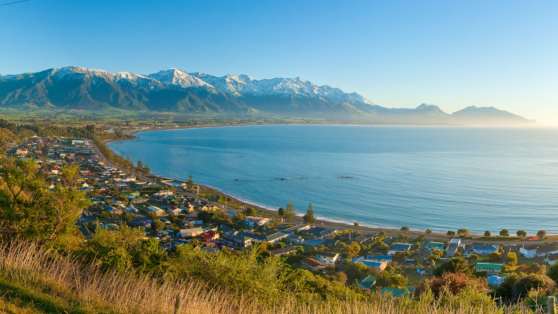
Kaikōura

Our Base

Our rafting base is perfectly positioned on State Highway 1 beside the Clarence River mouth, one hour south of Blenheim and 30 minutes north of Kaikoura.

Our Locality

Kaikōura - where mountains meet the sea

The Kaikōura Region

We're based in one of New Zealand's most spectacular and geologically fascinating regions. Kaikōura is renowned worldwide for its dramatic landscape where the snow-capped Kaikōura Ranges plunge directly into the Pacific Ocean, creating a unique environment found nowhere else on Earth.

The name "Kaikōura" comes from kai (food) and kōura (crayfish) - reflecting the region's abundant seafood. But there's much more to this special place than just its famous crayfish!

Geography & Landscape

The Kaikōura Ranges

The Seaward and Inland Kaikōura Ranges dominate the landscape, rising dramatically from sea level to over 2,600 meters in just a few kilometers. This extreme topography creates:

  • Dramatic Views: Snow-capped peaks visible from the coast year-round
  • Deep Canyons: Rivers like the Clarence carve through towering mountains
  • Tectonic Activity: Active faults creating ongoing geological drama
  • Diverse Ecosystems: From coastal to alpine environments in short distances

The Clarence River Valley

Our rafting operations are based in Clarence, 40 kilometers north of Kaikōura township.  The Clarence Valley where we raft offers:

  • Remote wilderness feeling
  • Spectacular mountain scenery on all sides
  • Visible earthquake features from the 2016 Kaikōura earthquake
  • Active fault lines crossing the landscape
  • High country pastoral farming heritage

World-Class Geology

The Kaikōura region sits at the junction of the Pacific and Australian tectonic plates. This creates one of the most geologically active areas in New Zealand, with:

  • Over 20 known active fault lines
  • Ongoing mountain uplift (1-6mm per year)
  • Regular seismic activity
  • Visible evidence of past earthquakes
  • World-class earthquake research opportunities

The 2016 Kaikōura earthquake put this region on the global scientific map - it was one of the most complex earthquakes ever recorded, rupturing at least 21 faults simultaneously.


Getting Here

By Car

Our rafting base is accessible via scenic drives:

  • From Christchurch: 2-2.5 hours (180km) via SH1
  • From Kaikōura: 1 hour (45km) via SH1
  • From Blenheim: 1.5 hours (85km) via SH1

Shuttle Service

We offer shuttle services from:

  • Kaikōura township: Complimentary for most trips
  • Blenheim: Complimentary for some trips, shuttle costs may apply
  • Christchurch:  Shuttle costs apply


Things to Do in the Area

Marine Activities (Kaikōura Coast)

  • Whale Watching: Year-round sperm whale sightings (world-famous)
  • Dolphin Swimming: Swim with wild dusky dolphins
  • Seal Colony: Walk among fur seals at Ohau Point
  • Albatross Encounters: See albatross up close from boats
  • Fishing: Excellent coastal and deep-sea fishing

Land-Based Adventures

  • Kaikōura Peninsula Walkway: Spectacular coastal walking track
  • Mountain Biking: Various trails including Molesworth Road
  • Hiking: Mt Fyffe and other alpine tracks
  • Hunting: Red deer, chamois, and tahr in the ranges
  • Photography: World-class landscape photography opportunities

Food & Drink

  • Crayfish: Fresh from the sea at roadside caravans
  • Local Restaurants: Excellent seafood dining
  • Wineries: Several cellar doors in the region
  • Farmers Markets: Fresh local produce

Accommodation Options

Kaikōura Township

  • Hotels & Motels: Range of options from budget to luxury
  • Holiday Parks: Camping and cabin options
  • Backpackers: Budget-friendly hostels
  • B&Bs: Charming homestay options
  • Holiday Homes: Self-contained rentals

Rural Accommodation

  • Farmstays: Experience high country life
  • DOC Campsites: Basic camping in scenic locations
  • Molesworth Huts: For those exploring Molesworth Road

Tip: Book accommodation well ahead in summer (December-February) as Kaikōura is a popular destination.

Climate & Weather

Summer (Dec-Feb)

Temperature: 15-25°C
Rainfall: Low
Conditions: Warm, dry, perfect for all activities
Note: Can be windy, especially afternoons

Autumn (Mar-May)

Temperature: 10-20°C
Rainfall: Moderate
Conditions: Stable weather, beautiful colors
Note: Excellent time to visit

Winter (Jun-Aug)

Temperature: 5-15°C
Rainfall: Higher
Conditions: Cold, snow on mountains
Note: Dramatic scenery, fewer tourists

Spring (Sep-Nov)

Temperature: 10-20°C
Rainfall: Variable
Conditions: Changeable, windy periods
Note: Wildflowers, higher river flows

Wind: Kaikōura can be windy, especially the nor'wester. The Clarence valley is more sheltered but still experiences wind at times.

Local Services

Kaikōura Township

  • Petrol Stations: Multiple options, fill up here
  • Supermarkets: New World 
  • Medical Centre: GP clinic and pharmacy
  • i-SITE Visitor Centre: Tourist information and bookings
  • ATMs: Available at banks and dairy
  • Cafes & Restaurants: Good range of dining options

Important Notes

  • No services in Clarence 
  • No mobile phone coverage on our multi day trips

Making a Weekend of It

Many of our guests turn their rafting trip into a full Kaikōura weekend. Here's a suggested itinerary:

Day 1 - Arrival

  • Arrive Kaikōura mid-afternoon
  • Check into accommodation
  • Walk the Peninsula Walkway
  • Fresh crayfish dinner

Day 2 - Rafting

  • Morning whale watching or swim with dolphins
  • Afternoon rafting on the Clarence River
  • Pizza lunch included with our trips
  • Return to Kaikōura for dinner

Day 3 - Explore

  • Visit seal colony at Ohau Point
  • Drive scenic coastal route
  • Wine tasting at local wineries
  • Depart for home

Quick Facts

  • Region: Canterbury
  • Nearest Town: Kaikōura
  • Population: ~2,000 (Kaikōura)
  • Distance from ChCh: 180km
  • Highest Peak: 2,610m (Manakau)
  • Main Industries: Tourism, farming, fishing

Driving Times

  • Christchurch: 2-2.5 hours
  • Kaikōura: 1 hour
  • Blenheim: 1.5 hours
  • Picton: 2 hours
  • Hanmer Springs: 2.5 hours

Times to our river base

Book Your Adventure

Half Day Rafting → Multi-Day Trips → Book Now →

More Information

About the River → River Grading → Photo Gallery →

Contact Us

Jordan: 020 405 1929
Nicole: 027 426 2027
This email address is being protected from spambots. You need JavaScript enabled to view it.

Explore Kaikōura & Raft the Clarence

Combine rafting with New Zealand's premier wildlife destination

Book Your Trip Plan Your Visit

To help you plan your journey, here's our exact location:

River grades explained
 

Understanding River Grading

The international classification system explained

What is River Grading?

River grading is an international classification system used to describe the difficulty and danger of whitewater rapids. The system helps rafters, kayakers, and river guides assess what level of challenge a river section presents, allowing people to choose appropriate adventures for their skill level.

The scale runs from Grade I (easy) to Grade VI (extremely dangerous and unrunnable). Most commercial rafting trips operate on Grade II-IV rivers, which offer excitement while maintaining reasonable safety margins.

Important Note

River grades can change with water levels! A Grade II rapid at low water might become Grade III or IV at high flow. Seasonal conditions, recent rainfall, and snowmelt all affect river difficulty. This is why professional guides constantly assess conditions and adjust trips accordingly.

The Grading Scale Explained

Grade I Easy

Characteristics:

  • Moving water with few riffles
  • Small waves, no obstacles
  • Easy to navigate
  • Self-rescue is easy

Difficulty: Minimal skill required

Suitable for: All ages, first-timers, young children

We Raft Here!
Grade II Novice

Characteristics:

  • Straightforward rapids
  • Wide channels, clear passages
  • Low ledges, medium-sized waves
  • Maneuvering required but simple

Difficulty: Basic paddling skills needed

Suitable for: Ages 5+, families, beginners

This is the Clarence River! Our trips navigate Grade II rapids – exciting enough to be thrilling, gentle enough for children and first-timers. Perfect for family adventures!

Grade III Intermediate

Characteristics:

  • Rapids with moderate waves
  • Complex maneuvers may be required
  • Clear routes need to be followed
  • Scouting may be advisable

Difficulty: Experienced paddling required

Suitable for: Ages 12+, some rafting experience recommended

Available on some of our multi-day trips and custom adventures for more experienced groups.

Grade IV Advanced

Characteristics:

  • Intense, powerful rapids
  • Precise maneuvering essential
  • May feature unavoidable waves and holes
  • Scouting recommended, rescue difficult

Difficulty: Advanced skills essential

Suitable for: Ages 16+, strong swimmers, rafting experience required

Occasionally available on custom multi-day trips during high water for experienced groups only.

Grade V Expert

Characteristics:

  • Extremely long, violent rapids
  • Following precise routes essential
  • Very turbulent water, large drops
  • Rescue very difficult, risk of injury high

Difficulty: Expert skills absolutely required

Suitable for: Expert rafters only, significant risk

Not offered on commercial trips – for expert kayakers and rafters only.

Grade VI Extreme

Characteristics:

  • Nearly impossible and very dangerous
  • Exemplifies extremes of difficulty
  • Serious risk to life
  • For teams of experts only, under perfect conditions

Difficulty: Considered unrunnable

Suitable for: Virtually no one – extreme danger

These rapids have rarely been attempted and pose extreme risk. Not appropriate for commercial rafting.

Factors That Affect Grading

Water Volume

Higher water levels generally make rapids more difficult and powerful. A river at flood stage can be several grades higher than at low flow.

Wave Size & Power

Larger, more powerful waves increase difficulty. Standing waves and hydraulics (holes/stoppers) add complexity.

Obstacles

Rocks, fallen trees, undercuts, and other hazards increase the grade, especially if they create unavoidable dangers.

Gradient

Steeper rivers flow faster and create more powerful features. Even small changes in gradient affect difficulty.

Route Complexity

How easy or difficult it is to see and navigate the correct route through a rapid affects its grade.

Rescue Difficulty

Remote locations, cold water, and difficult terrain all increase the consequences of problems, raising the effective grade.

Why We Focus on Grade II

At Clarence River Rafting, we primarily operate on Grade II sections of the river for excellent reasons

Family Friendly

Grade II is exciting enough to be fun but gentle enough for children as young as 5 years old (conditions permitting)

Time to Learn

The manageable difficulty allows our guides time to teach about geology, ecology, and river features without constant focus on navigation

Enjoy the Scenery

You'll have time to look around and appreciate the stunning mountain views and geological wonders - not just survive rapids!

High Success Rate

Almost everyone completes Grade II trips successfully, making it an achievable challenge that builds confidence

Still Exciting!

Grade II rapids provide plenty of splashes, waves, and thrills - most first-timers find them plenty exciting

Safe Learning Environment

If someone does fall in (rare), rescue is straightforward and the consequences are minimal.

Frequently Asked Questions

Is Grade II too easy for experienced rafters?

Not at all! While Grade II is accessible to beginners, experienced rafters still enjoy the stunning scenery, geological features, and social aspect. Plus, on our multi-day trips, we can access more challenging sections.

Frequently Asked Questions

Not at all! While Grade II is accessible to beginners, experienced rafters still enjoy the stunning scenery, geological features, and social aspect. Plus, on our multi-day trips, we can access more challenging sections.

River levels can change, but not usually during a single day trip. We monitor conditions closely and will advise if a rapid is running higher or lower than usual.

Grade II rafting is roughly equivalent to a “green” (beginner) ski run or an easy mountain bike trail – challenging enough to be fun, safe enough for first-timers.

On our multi-day trips and some custom adventures, we can access Grade III sections for more experienced groups. Grade IV is occasionally available during high water for very experienced rafters.

Contact us about our multi-day trips or ask about accessing different river sections. We can often customize trips for experienced groups seeking more adventure.

Clarence River Grade

Grade II

Perfect for: Families, first-timers, ages 5+

Challenge level: Exciting but manageable

Experience needed: None

Quick Grade Reference

  • I: Flat water, easy
  • II: Novice (← We raft here!)
  • III: Intermediate
  • IV: Advanced
  • V: Expert only
  • VI: Nearly impossible

Ready to Experience Grade II?

Half Day Trip → Multi-Day Adventures → Custom Group Trips →

Learn More

About the River → Safety Information → FAQs →

Experience Perfect Grade II Rafting

Join us on the Clarence River for family-friendly adventure

Book Your Trip Learn About Our Trips
  1. Waiau River
  2. Custom Trips
  3. Multi-day Clarence (2)
  4. Multi-day Clarence (3)

Page 2 of 3

  • 1
  • 2
  • 3